Stage 1 - St Bees to Ennerdale Bridge - 16 miles (176 miles to go)
Route / Ascents used:
St Bees, north along coast, via the lighthouse, Cleator Moor, over Dent Fell (1,155 ft), around Flat Fell to Braken Wreay Farm
I arrived in St Bees late afternoon on a gorgeously sunny Sunday after a lovely journey via the western lakes. We checked into the lovely Stonehouse Farm B&B and straight away, problems started to emerge!! Hello!
I brought in my incredibly heavy bag intended to be ferried between each stage by Sherpa (the company I had booked the trip through), only to be told, "Your bag looks too heavy!" This was of course due to all the dog food I had packed for the 2 weeks, all in sachets, but weighing alone, about 5 kgs. I was warned the limit was 20 kgs and that the previous week, a bloke had been dragged back from Ennerdale Bridge by the company to split his pack and pay double. I had to weigh the bag, using what amounted to a fishing weighing scale, and of course, holding my bag by 2 fingers was almost impossible. Even though I knew it would get lighter as I went along as Rufus ate his way across the country, I resigned myself to having to split the pack, and nabbed a bag off my Mum to use.
To put this problem out of my mind and focus on the job at hand, I strolled down to the beach to understand the start point and get a feel for the place. I was really surprised by how lovely the beach was at St Bees, which was being well used by the locals, most of whom were gamely swimming in the Irish Sea! I had heard that the start was a bit dour, but this proved to be very wrong, and a pleasant surprise.

So, the next day, in the morning, I came down for breakfast, and met the owner, who said my bag seemed fine. We weighed it again, and found it actually weighed 21 kgs, so only 1kg over the limit, and she advised me to place some of Rufus' dog food in my pack. This amounted to 4 sachets, which of course added a further 1 kg to the weight of my pack. My pack comprised of the following:
1. Camel pouch, filled with 3 litres of water, weight about 3 kgs
2. Spare pair of walking boots in case of blisters or fatal decay in my faithful old boots. Weight 2kgs
3. Waterproof coat and trousers, plus spare shirt for warmth. Weight 1 kg
4. SLR camera and zoom lens, weight 1kg
5. Sat Nav, suncream, insect repellent, first aid kit, maps, Rufus' water bowl. Weight 500 grams
6. Packed lunch, weight about 500 grams
7. Rufus's spare food from main bag. Weight 1 kg
So all in all, with the weight of the back pack itself, I was carrying about 10 kgs in weight on my back or 22 pounds, just to add insult to potential injury!
We set off for the start, and the weather drew in, and looked ominous, so I made sure I wore my coat, (but take note from the picture below, not my waterproof trousers, my first fatal error!).

Note Rufus is wearing his walking boots as instructed by the vet. Looks a proper walker now doesn't he?
After saying my farewells, off I set up the cliffs to walk several miles due north, not east, as Wainwright who devised this walk was quite frankly, a sadist!
Rufus was struggling with his boots to be honest. He was used to dragging his front feet, but found if he did this in his boots, he simply crumpled in a heap, hitting his chin on the deck as the Vibram soles gripped the ground unlike his claws. He took to walking only on grass wherever he could find this.
 This is the image you have all been waiting to see, but poor old Rufus hated wearing the boots.
As I walked on to the lighthouse, I could feel the first drops of rain, and then the heavens opened. And down came the rain, and never stopped for the entire day. I decided it was far to inconvenient to take off my map and pack to unload the waterproof trousers, so just soldiered on. Mistake! My trousers simply absorbed all the water and stuck to my thighs, making it twice as hard to walk.
At a simply horrid village of Moor Row, Rufus decided he did not want to go on anymore in his new boots, so dug in his heels and refused to budge. He was really unhappy with his front boots and the effect it was having on him, so I removed them and left the rear ones on, protecting his recently operated on rear paw. On we went.
The path over Dent Fell was non existent and the ground was horribly boggy. My boots, which were full of holes simply filled up, and on I squelched. The final route to Ennerdale bridge and our B&B at Bracken Wreay Farm, took us alongside the road on a narrow path flanked by bracken. This was absolutely soaked with rain, and slapped yet more water onto my shorts and into Rufus' eyes. He stopped twice more, and refused to move on. I was furious by now, shouting, "don't stop here for God's sake, let's get to the farmhouse and the dry". Of course, he didn't understand this, and thought I was taking him on an endless journey to hell.
We arrived at the farm at about 15.30 via an amazing enchanted trek through their private woodland, with signs dotted here and there to keep you on track. I was greeted by the owner, who took me via the farmyard into their enormous utility room, lovely and dry and incredibly warm. This was destined to be Rufus' prison for the next 12 hours! Dogs were not allowed anywhere else in this place. For those who know Rufus, you will have heard he is clingy, and suffers from separation anxiety if left apart from either Karen or me. This should be interesting.....
The owner declared that I should remove anything I wanted to be dried, and she would guarantee that anything I left her would be dry by the morning. OK, I thought, and took her at her word. I left Rufus yelping and crying, and scratching like a mad howling banshee at the utility room door, as I removed everything, including my underpants, and handed these, along with my boots to the generous host! I then went for a shower, wondering how long would they be able to put up with the cacophony of canine howling before making a comment. I then made myself a cup of tea, and counted the seconds before they would make a statement about the noise. Sure enough, after 20 minutes a knock came at the door and she said, "I think Rufus will be dry by now. Do you want to bring him to your room?" So the boy got his way in the end, and up he came to spread out in the rather grand private lounge area I had to myself:

They were really generous hosts, and I was given a lift the couple of miles into Ennerdale bridge to the pub for my dinner, and a lift back at the end. I appreciated this as my limbs were sore, and Rufus was showing signs of wear and tear already.
Overnight, Rufus started to lick at his front right paw furiously, so I started to expect the worse and wondered if this was a challenge too far for him. In the morning it was not much better, so I rang karen to warn her I might need to offload poor Rufie so I could carry on. We gave it the next stage to test him out, and I would call on arrival to say if he was OK to carry on.
End of Stage One.
Stage 2 - Ennerdale Bridge to Rosthwaite - 17 miles (159 miles to go)
Route / Ascents used:
Round north side of Ennerdale Water, 10 miles to Black Sail Hut, scaling Loft Beck via Grey Knotts (2,287 feet) descending to Honister Pass via the old slate tramway and down to Rosthwaite via Johnny's Wood.
Today, I was very concerned about Rufus who continued to show signs of being slightly lame in his front right leg. As I mentioned, he was now only wearing 2 boots on his rear feet. We soon got into the swing of things, with an endless long trudge around the north side of Ennerdale Water towards the Black Sail Youth Hostel hut. I was taking full precautions today, with full waterproof gear on, and typically, the weather was boiling hot with few clouds in the sky!

I had walked about 4 miles round the lake when I noticed Rufus was only wearing one boot! Damn! Where did he lose the other one. he wasn't up for telling me, so it was off back in the other direction I had come from! I met a young couple coming my way and asked if they had seen it. Oh yes they said, about 3 miles back to the beginning! S***! Off I went. luckily, I met a older couple and asked, and he had picked it up, thinking I would come back for it. So I took off the other boot and kept them safe. Now Rufus felt happy, and was walking well again. Hopefully this was what was troubling him.

I won't say this is Rufus looking happy, but he was walking a lot better.
On we trudged to Black Sail where I met up with loads of walkers, some doing the C2C, and some just out for the day, and others who were mountain biking this route. I got chatting to the 2 mountain bikers, and they said they were cycling on the Pillar high route the day before when the weather was really bad, so had to come down. This is Pillar taken by me on the route to Black Sail:

They were hardy souls! They seemed keen to tell me which way to go next, so I recanted a tail where I asked a local guy whether a mountain I was pointing at was Old Man of Coniston, or Dow Crag. "Well if tha' doesn't know where tha' is, tha' shouldn't be 'ere" he replied. I mentioned this to make it clear, I dare'd not ask, and hoped I didn't need to. he chuckled, and said he would probably say the same. I suggested it might have been him then. "thanks" he said, rather proudly!
I then set off up the hard steep slog to the top of the first mountain range of the lakes. The image below shows what I had to climb over:

I was being chased by 3 people comprising a young couple and an elderly woman. They caught me up, so again, got chatting as you do. The young girl says, "go on, guess my Mum's age? This was her idea to do the C2C". I said it would be rude to guess a woman's age, thinking she looked about 75, and was told she was 76, which was a good guess on my part. The problem was, she was utterly amazing, and kept saying, "go on love, your young, go ahead, and I will trail at the back". The problem was she was like speedy Gonzalez, and kept pushing me up the sheer climb much faster than I wanted to go. Jeez! I was knackered! We eventually got to the top, and were afforded this fantastic view:

It was at this point I realised my old OS maps didn't have the C2C permissive paths on it, and I was due to trudge high up to find the path down to the Honister Slate Mine. Luckily the guy with us had a sat nav with the entire route mapped out on it, and he directed us all to the correct point, which saved my legs a bit. Lucky too, as it was really boggy up top.
It was a nice walk down into the valley via a wood alongside the river all the way into Rosthwaite, where I arrived tired out and ready for a bath at the Royal Oak. I assumed this would be a homely pub, but it turned out to be a half board hotel stuck in the 19th Century. Absolutely fantastic! I was greeted by a stern lady, who instructed me of all the rules, including the fact Rufus was allowed anywhere, apart from the dining room! Here we go again! Then proceeded to announce that dinner would be served at 7pm sharp and breakfast would be served at 8.30 am sharp in the morning. The room was lovely, with a massive old fashioned bath which I filled to the brim and had a fantastic long soak. I was woken from my slumber by a loud gong. it was dinner and yes, they actually bashed a brass gong to bring all the guests down to dinner! Rufus was asleep, so I tried to sneak out, keeping my ears open for the banshee wail!
I managed to get through my carrot and coriander soup before the racket began, and I knew he had woken from his slumber. I went up there, to see sheer terror in his eyes as he thought I has abandoned him, and he actually had tears in his eyes, as he hugged me. What a sissy!! I went back downstairs and declared dinner was off for me as my baby was too upset. I was told it would be fine to retire to the lounge where they would bring the rest of my meal to me on "me todd" as they say. Billy no mates again! So I scoffed the rest of my meal plus coffee alone, until the rest of the hotel retired also to the lounge for polite chat and coffee. God, I felt like I was in a Jane Austin novel! I made my polite excuses, and went off to bed to get ready for the hellish trek tomorrow, 2 stages in one, with 2 huge climbs in one day.
In the morning, I got around my cry baby Rufus problem by tethering him to a bench in the bar, and waving to him from the dining room. That should have worked, but apparently, 30 feet is far too far away for his nibs satisfaction, so the wailing tears broke out again, so I had to finish my breakfast in the bar area. yes, on my own again!
After picking up my rather large pack lunch, I was off.
End of Stage 2
Day 3 - Rosthwaite to Patterdale - 17 miles (142 miles to go)
Route / Ascents used:
Up valley under Eagle Crag, steep ascent to Calf Crag (1,762 feet) and descend to Grasmere under Helm Crag. Climb again via The Tongue to Grisedale Tarn (1,880 feet) with descent under St Sunday Crag down to Patterdale.
The weather was good again today, so dressed down for a change. The approach to the first climb under Eagle Crag was lovely, and a good gentle start to the day.


At the top of the first ascent, Rufus decided to make himself at home and chew on a stick!
Once the climbing started, it was tough, tough, tough, and I had to put out of my mind I had it all to do again later in the day on my second climb. I got to the top of Calf Crag and onwards to Greenup Edge around midday. It was horribly boggy at the top, and took an age to navigate around, but it was impossible not to get a thorough soaking in my leaky boots. Rufus played King of the Castle at the summit of this initial days climbing.

My feet was absolutely swimming by the time I got to the descent. However, we had a glorious descent down to Grasmere:

It took me longer than I thought to get down to Grasmere, as I had to round the bottom of Helm Crag to get round to the busy A591. We ate our pack lunch in view of the next ascent to Grisedale Tarn via the Tongue:

You can see the route up here over the tops for my second climb of the day.
Once I got to the Tarn, I was so relieved and thought that was all but it for the day. Rufus was happy to have a swim and cool off as well.

The view at the Tarn was slightly spoilt by the garish flourescent orange tents, but I am a purist, and felt it was an intrusion.
Oh my God, my feet were hurting now, and I checked my Sat nav to find out we had over 4 miles left to go, all the way down the valley to Patterdale. I was down to practically 1 mile per hour now, and my water ran out just below the summit. I eventually arrived at the White Lion Inn in Patterdale at about 6.30pm absolutely knackered and with agonising pain in feet. I was lifted when I was greeted by 2 friends I met in St Bees, Stu and Lou, who were walking for Help the Heroes. They had had an equally bad day, the day before, as they were pushing hard to complete the route in 10 days, and had allowed themselves to be persuaded to go the high route on day 2, and climbed an additional 4 mountains. Lou had damaged her knee and Stu had bad blisters. I guess you could say Stu and Lou bit off more than they could chew, but to be honest, they were really strong walkers and battled through the pain barrier each day. Speaking of which, I got my boots and socks off, and saw the damage to my feet. Looked like a case of trench foot, with weeping sores on the tops of most of my toes from all the muddy water sloshing around in my boots combined with a full days rubbing. I hope they repair themselves overnight!
I had a seperate shower down the corridor, which was like a postage stamp, but of course had to squash Rufus in there as well to avoid a wailing scene. The bloke from the room down the corridor must have thought I was mad, cramming my dog into the toilet!
I need to thank Stu for his recommendation of the steak and kidney pie that night. It was bob on, and just what the doctor ordered.
Off to bed, after ordering the next days pack lunch.
End of Stage 3
Patterdale to Shap - 17 Miles (125 miles to go)
Route / Ascents used:
Climb flank of Place Fell to Angle Tarn, over Rest Dodd (2,287 feet), up to High Street ( 2,493 feet) and up to Kidsty Pike (2,559 feet), descending to Hawswater, along full length and on to Shap via Shap Abbey.
today we reach the highest height of the whole C2C trek on top of Kidsty Pike at £2,559 feet. However, I do not see this as being as tough a day as the 2 stages in one I did yesterday.
I got off to an early start as this was a long days walk with tough climbing. I got this amazing photo as I crossed the bridge to start my ascent to Angle Tarn:

Soon after this, I was passing an enclosed field and saw 2 deer moving on. The mother simply ran and jumped over the wall and barbed wire fence, clearing it easily. then her young buck had a go, and landed right on top of the barbed wire. It would have brought a tear to my eye, but this little animal simply shrugged it off and went off its own way.
After a short climb, I was afforded this great view back the way I had come the previous day, with a good view of St Sunday Crag and Fairfield.

I also got my one and only view of Ullswater, my favourite lakeland water, with Glenridding on its shores.

That is Sheffield Pike behind Glenridding, whcih I climbed at 5.30am many years ago, just to get a pin in the map!

Looking due South, you see Brothers Water, one of the least visited, but beautiful non the less, with a great pub on its shores.

And here is Rufus looking very proud of himself, having climbed so high for the day.
We soon rounded the bend and came to my absolute favourite tarn in the lakes, Angle Tarn. I like it so much because it actually has character, with an island in the middle and trees growing with sheep grazing. Absolutely lovely.

The views from the top here back over the entire lakeland fells was stupendous, with practically every Central fell on view with unlimited visibility.

It was at this point, I seemed to have missed my turning on the high fell top, and ended up climbing up to the top of Rest Dodd instead of High Street. The funny thing is, I had an entourage of about 10 walkers followed me up there thinking, "he must know where he is going, he has 2 maps and a Sat Nav". Oh dear, what a bunch of sheep. They later asked me if I had intended to climb Rest Dodd as part of my intinerary. What could I say. Well, I lied of course, and said it was always something I had a burning desire to climb. Why, did they not mean to?!!
Once I got back on track to High Street, we now had the chance to see Hawswater for the first time, round the base of Kidsey Pike, the high point of the entire route.

You can see Rufus looking down on his destination, and the prospect of his share of the best packed lunch we got on the entire trip!
It was not far now to the top of Kidsey Pike, our high point for the trek. Here is Rufus looking very proud of himself.

The climb down to Hawswater was absolute torture, and very steep. Once down, I was ready for a break, and lunch, but some other walkers had stolen my spot, so I walked on found an even better spot. they were jealous when they came round and saw the viewpoint I had comandeered.

The walk to the end of the reservoir (this is not a lake, but essentially man made, by flooding a village) was endless (6 miles in all, so 3 hours walking). I was not expecting the route from there to Shap to be very nice, but again, was pleasantly surprised. It was lovely walking alongside the Hawswater Beck.
Eventually, I came to Shap Abbey, which I expetced more from, but all I got was chased by some demented cows. This is a problem you experience when you enter a field of cows with a dog on a lead. Rather than walk away, they walk towards you, and start to snort. There have been loads of deaths recently, and you are taught to let go of your dog and run. Bugger that, no fat cow is getting my Rufie, so I just swore at them at the top of my voice, and made them go away.
I found a lovely, totally unused footpath into Shap, which was a treat. Putting aside the nettle stings, it was a lovely end to the day.

I stumbled into Shap, and asked where the Greyhound Pub was. "Oh, that's the very last building before you leave the village", said the local lady helpfully. Bugger!
The hotel was the poshest thing I stayed in all trip. They had 2 dressing gowns and 2 pairs of slippers. The gowns were too big for Rufus, so i gave him the 4 slippers to lounge in!
Rufus behaved like a yob in the morning, and weed on the wallpaper in reception as I was paying the bill. At least he waited until I paid, so they couldn't add the cleaning bill to my invoice!
End of Stage 4
Shap to Kirkby Stephen - 20 miles (105 miles to go)
Route / Ascents used:
Over M6 motorway, over Crosby Ravenworth Gill (1,171 feet), Orton to Sunbiggin, over Ravenstonedale Moor, Smardale Bridge to Kirkby Stephen
Today is due to be a long slog, but no real energy sapping climbs, or boggy marshes due. The first major hurdle is getting over the revolting M6, a necessary evil as we leave the Lake District behind us. I am pushing as hard as I can, but am in the midst of an army of C2C'rs all out early this morning. As I haul myself over the foot bridge over the Motorway, I look back and see Stu and Lou running towards me. This is a nice surprise, as it looks like I will have company for the first time on the walk. I can't for the life of me think how I can assist, as once I get gassing, I totally lose my bearings, but this could be fun as the blind lad the blind. You will understand more about this at the end!

revolting bridge over M6
It becomes apparent that Stu and Lou have a nickname for all the groups of walkers they have come across in the previous 4 stages. I can only guess I was one man and his dog! Perhaps they will tell me one day. We seemed today to keep coming across "Man and Boy" on the next 2 legs, who comprised of a domineering father and his brow beaten, sullen looking 17 year old son, marching 800 yards behind his dad, with absolutely no stops on route. We guessed this was a bonding experience, but looked more like an expert class in domineering. "Man" didn't understand the word path, merely direction, so often attempted to persuade us to forge across bog and treacherous ground to get to the same point everyone behind us had reached 15 minutes ago via the path!
This image below is a good example of this practice. Here, we reached the top of a limestone pavement, and "Man" pointed the way to go in a direct line, which he swore blind would cross the stone circle the "fragrant" Julia sat on in her C2C series.

Note "Boy" trailing behind
The thing is, firstly, there was no stone circle beyond this limestone pavement on the map, it is later on near Sunbiggin. Secondly, the path is actually 800 yards over to the left. However, we were ordered to forge our way over heather moorland. By and by, "Man" comes to a clearing in the heather, no more than a blob of grass with 3 stones in it. "Here we are", says "Man". "What?" says I. "This is the stone circle", says "man", as he proceeds to take a photo of the grass clearing. I asked Stu what he was taking a picture of. "God Knows" says Stu. In my best diplomatic way I say, " Well, even if that was a stone circle, I wouldn't waste my time taking a photo of it".
What we found out was that if "man" couldn't find something, or if he wanted to create some magic that didn't exist, he would simply make it up, and convince himself it was there. Having said that, he did have some spiritual qualities about him though. I lost count of the number of times he was well behind us, then appeared ahead of us having created his own C2C route, and imagined it to be the one Wainwright created in the first place.
This imagination stuff happened again the next day when he invented a waterfall named after his illustrious author called "Wainwright Falls". There was no such place of course, it was actually called Wainwath falls, but this didn't stop him taking a photo for his wainwright scrap book. See falls in question below:

I took a picture of the Wainstones in the Cleveland Hills, thinking "Man" would have called these the Wainwright Stones and had a positive orgasmic experience. Well, here they are!

The funny thing about today was that I suggested we shouldn't stop for lunch until we had walked 10 miles and could say we were halfway for the day. I was wearing a pedometer, which has always proved pretty accurate. I checked it after a few hours, and it said we had walked 6 miles, so psyched myself up for a further 4 miles before we stopped. I clearly hadn't shut the device properly, so it stopped counting my steps, so 4 miles later I checked again, and it said 6½ miles, and in my delerious state, thought nothing of having only walked ½ mile in 2 hours! Therefore, when asked at 10 miles if we could stop, I said not for another 3½ miles! Now who was domineering? So on we forged to 14 miles before we stopped, clearly 75% of the way to Kirkby Stephen, for our well earned pack lunches.
The views to the Pennines that we would be crossing tomorrow werte glorious in the sunshine, and looked really enticing


This truly is the road to nowhere!

I thought this was a gorgeous image looking down on Smardale Bridge
Since the challenges were few and far between on this leg of the journey in terms of no hard climbs or descents, we had to make up our own challenges. these came in the form of our collective navigation skills, or lack of them. Now one would think, if a sign on a gate said, "C2C turn right at gate, and keep to wall", then that is precisely what you would do. But Oh no, not us. We had an OS map, sat nav, 2 x C2C maps, a compass, and a detailed book, and 3 heads, and collectively decided the sign was put there by a belligerent farmer, and decided to go straight ahead keeping the wall to our left! We even met a local lady who said, " most C2C walkers go back the way you came from, and walk over the fell, and save a mile off their journey". Oh no, she doesn't know what she is talking about, on we go. Then all of a sudden, uh! who put that railway bridge across our road, that's not on the map! Oh bugger. We should have turned right at that gate and walked over the fell. Oh well, sod it now, we might as well continue as we are. So we continued, and added an extra mile to our already long leg.
We were pleased on arriving at Kirkby Stephen to find our accommodation central, and agreed to meet up again later that night for a meal. After a long wait of over 2 hours, we managed to get our orders in for 2 T-Bone steaks rare and one sirloin steak rare for Lou, after 9PM, way past our bed times! Our 2 steaks came as ordered, massive and bloody and juicy and gorgeous. Unfortunately, Lou's came burnt to a crisp, and she was not amused, especially seeing us drooling over our steaks.
Now may be a good time to describe Rufus' dinner routine as well. I had no room, or weight allowance to carry a proper dog bowl for Rufus, so had a collapsable water bowl for the treks, and a small tupperware plastic container for him to eat his dog food from. I used to feed him 2 pouches of food in the evenings in this. The problem was the container was so light, Rufus would end up chasing the bowl all over the bathroom in each B&B trying to get the food out. He always ended up under the back of the toilet when the container would come to a halt at the waste pipe. Poor Rufie. He would finish his second serving later in the night as a midnight snack, always waking me up as he banged against the toilet trying to get the last morsels out! Ughhh!
The next day, I had the same problem with cry baby Rufus as in previous places. he was not allowed in the breakfast room, so they had to make up a solitary table in the bar for Billy no mates to eat breakfast alone again! At least I can feed Rufus his sausage and bacon without disapproving looks.
End of stage 5
Kirkby Stephen to Keld - 13 miles (96 miles to go - adjusted for navigational errors, actual distance covered to date is 100 miles)
Route / Ascents used:
Hartley to the Nine Standards Rig (2,172 feet), to Ravenseat Farm via Whitsundale Beck to Keld.
I walked this stage with Stu and Lou who were going onwards another stage today to Reeth, as they were doing the walk in 10 days. This would be the last chance to walk with them, and we knew there were navigational difficulties around the nine standards Rig, so this should be interesting......
The start of the walk was easy navigation, along minor road and clearly defined track. The problems begin as you branch off the many routes to get to the Nine Standards. Due to erosion, they shift the path seasonally from the December to April route to the May to November, and further along 2 further mandatory options seasonally based for August to November and May to July. All this means that the paths are never that distinct, and the landscape is generic moorland of heather and rolling hills. You will see the problem a little later on.
We eventually got to the summit of Nine Standards Rig in good time after a relatively easy but endless climb to 2,200 feet. Below are some images of the Nine Standards. Their origins are a mystery. Some say they are only 200 years old, but evidence suggestes they could be over a 1,000 years old, and probably represent an ancient burial site. One thing I can tell you is it was cold, wet and incredibly windy as you will see from the 2nd image below.
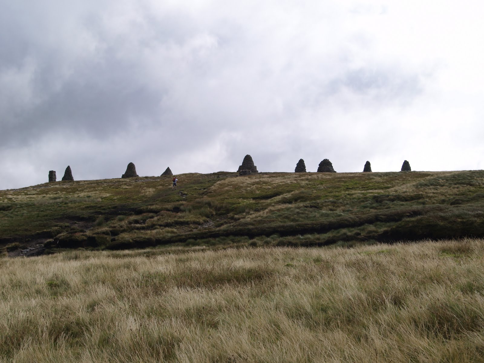
Here are the nine standards in all their glory.

You can see that Stu and Lou can hardly even stand up it was that windy.

The intrepid Rufus posing at the top!
Now things started to get interesting as we attempted to find the path from here down to Ravenseat Farm. Problem is, there was no path. I stupidly forgot to use my sat nav and just took a compass reading, and declared we should march in the direction my compass dictated a la "Man and Boy" stylie. The problem is, it is nigh on impossible to walk across heather moorland. You are for ever falling into holes and it is really energy sapping. In the end, I decided we should follow the Backstone beck in a long arc round to the path that ran alongside Whitsundale Beck. I have to say, I really enjoyed this. You had to continually jump across the stream on stepping stones as it winded its way around to our destination. The problem is this added an extra couple of miles to our journey, and would not make it any easier for Stu and Lou to make it onwards to Reeth today. Rufus was having a ball, flushing out grouse, and chasing them, bouncing up and down. I walked ahead to make sure we could navigate all the way down the stream, but Lou was lagging behind at this point. When we eventually got back to the main path, I waited for the other 2 to catch up, and asked if all was well. I just got a snarl from Lou who said, " If I have to cross another F****** stream, I'm going home!" Euowhhhhhh!! Touched a raw nerve there I think. Sorry Lou!
In actual fact, the main path was far far worse than the luxury of my babbling stream. It was a nighmarish bog, sinking up to your kneees in parts. My boots were utterly full to the brim in sticky wet mud, and I could sense my feet decaying with every stride. It was really hard going, and after several hours, we were chuffed to see the welcoming sight of Ravenseat Farm. This featured on the Julia Bradbury C2C series, and the farmers wife supplies piping hot tea or hot chocholate and scones and jam to order. We sat down to have our pack lunches at the helpful picnic tables, only for the heavens to open. We all had to dart for the barn, where about 15 of us huddled shivering clutching hot cups of tea.
The farmers wife was a real character, with 5 children, 4 of whom we recognised from the TV series, parading around the farmyard. She lives miles from anywhere, so had delivered a couple of the children herself, with her husband delivering another. The journey to Nothallerton being over 40 miles means she rarely makes it in time. She was full of funny anecdotes, which were recanted as if they happened yesterday, but could well have happened several years ago, but funny none the less. She told a story of a lady getting stuck up to her waste in the bog, a large "rotund" lady as she described her, who rang her B&B to get her out. We instantly cried wolfe at this as there was no chance she had a bloody phone signal up there on the moors!! However, she continued to say she arrived in tears and begged for a lift to Reeth so she could call a taxi to go home. She also told a tale of a chap who had abused his dog (beating him), and having a fell walker chase him all the way down to the farm and through and beyond, cursing him and trying to dish out the same treatment. Again we cry foul, no human being could run down to the farm for fear of sinking up to their necks in mud, but again, amusing at the time.
Rufus was now showing signs of having had enough. He was thinking, I don't mind walking, so don't get me wrong dad, but it's pissing down, cold, and I'm knackered. I am, in a dry barn, being petted by lovely people, so if it's all the same to you, I think I'll stay here! I kid you not, when I got the lead out, he cowered to the back of the barn. I had to drag the poor bugger out into the rain. The reason? We had to get to Keld by 3pm so we could watch Leeds in the Challenge Cup Final! I don't think Rufus gave a toss about Rugby, and to be frank, neither did I, but I didn't want to let Stu down. Off we went.
You already know we came across "Man and Boy" on the road into Keld as he was taking his picture of the fictitious "Wainwright Falls", see picture in previous stage.
We arrived in the lovely picturesque village of Keld, of which I am afraid I have no pictures dear reader, as it was raining, and I was beyond caring to be frank. I collapsed into the Keld Lodge, where I was promised a single "pod" for the night. I had no idea what this would be, but found it to be a matchbox room with a single bed and a sink. I couldn't have cared less. I came down to watch the rugby on Stu's Ipod phone, and was delighted to see Warrington beat Leeds, but sympathised with Stu none the less. At the end, we had to say our farewells, as they had to continue onto Reeth, my desination for tomorrow. Bon voyage mes amis.
Unfortunately, Rufus was now seriously lame, and could hardly walk atall. He was, to be honest, laying it on with a trowel! He was attracting loads of concern from the owners, and guests, and I had to bathe his front paw in warm salt water. Clean it with hibiscrub. Dry it, and basically mollicoddle him. He really is such a sissy dear reader. We were all aching like buggery, and just had to get on with it. However, since Rufus was oblivious to my challenge, I felt it appropriate to ring Karen and moan to her that Rufus needed picking up, so could she make her way up from London and pick him up. If he couldn't walk by the morning, I was going to have to leave him at the lodge and Karen would pick him up from there. As it happened, Rufus was 100% fine in the morning, his atttention grabbing audience having moved on, so no panic just yet, but I was going to keep my eye on him none the less.
End of Stage 6
Keld to Reeth - 13 miles (83 miles to go)
Route / Ascents used:
Low route via Birk Hill and down to banks of River Swale, Muker, Gunnerside to Reeth
Due to the state of Rufus' health and fitness (and I do mean Rufus and not me dear reader!), I agreed with Karen to take the low level route to Reeth along the River Swale. Based on the performance of Rufus, we would decide if karen needed to come up and collect him so I could continue the walk without worrying about lasting damage to his health. In any case, I had decided weeks ago this was potentially the ugliest stage, with masses of scarred industrial landscape up top from disused lead mines. To many, this is a turn on, but not to me I am afraid.
As it happens, Rufus was putting his paw down this morning, and I don't mean like a human, putting his foot down and saying, "damn it, I've had enought of this walking!". I mean he could put his paw down and take weight on it. I therefore start to assume he is a drama queen, seeking attention. Off we set!
As I mentioned, we agreed to go the low route, and I assumed this would therefore be an easy ride. Just 13 miles of flat walking. Oh dear, when will I ever learn? The start of this walk, to be honest was probably the most hair raising and difficult of the entire trip! I had scanned the map the night before in Keld, and saw if I took the path to the right of the River Swale, after 2 miles it would eventually cross a foot bridge to the left bank and from there an easy route all the way to Reeth. When will I ever learn. I should have realised something when there were no foot prints anywhere I was going at first. As it happened, I climbed rapidly on a slippery muddy trail no more than 12 inches wide up to about 100 feet. The "path", if you want to call it that, was blocked every 20 feet by fallen trees that could not support themselvs on the severe slope. I therefore had to either physically climb over each one, and ensure I dropped precisely onto the narrow rack, and didn't slip down the sheer drop, or climb under. When I had to climb over, the trunks were covered in moss and were wet and slippy, so this was really dangerous. When I climbed under, the walking poles (I never used by the way) strapped to my back pack would get caught in the branches and jerk me backwards. I was cursing my luck yet again, and wondering if I would have to negotiate this assault course all the way to Reeth. Rufus didn't notice, so now who's the sissy?!
I daren't take out my camera, but had to photo this rock splinter perched precariously on the path. It was amazing.


You can see here how narrow the track was and the sheer drop down to the river. Also, Rufus without a care in the world.
Eventually we started to drop back down to sea level and safety at last. Now all I had to do was walk on the right until I came to the foot bridge. Did I say it was 2 miles? So why in the name of God did I fight my way through some overgrown track to cross a private SWING BRIDGE of rotten timbers just ½ a mile down the path?

Here we are on the private bridge with Rufus wondering how far the drop will be when the timbers give way.
We retrace our steps, and I must say Rufus is much more forgiving of my navigational errors than I am of his! We eventually get it right and have a very pleasant stroll along the River Swale for miles. There were countless styles to carry Rufus over and also those gaps in the wall about 18 inches wide with a slab of slate blocking all but 6 inches of it. I was constantly amazed at the design of these styles. I could just about fit one of my thighs through, and whilst fat buggers they are, believe me, there were many women I walked with who couldn't do that folks! Also, Rufus could only get his head through and then get stuck. This meant I had to use his harness handle to lift him about 3 foot up to get him over the wall, whilst I stood wedged in the gap . I am positive these devices were simply designed as a sick joke by Yorkshire farmers to wind up ramblers. We also had several more encounters with viscious cows en route. On one occassion, after carrying Rufus over an exceptionally high wall, and then running the gauntlet of savage cows, I dropped my C2C map, and didn't realise until about 1 mile further down the route. Oh, you should have heard the choice language folks at that. I did laugh, ha ha ha. "Oh flipin 'eck, what a shame", said I, and chortled as I walked the mile back to the mad cow pen.

Here you can see Rufus looking out for cows.
Rufus was having a ball sniffing out rabbits. He was obsessed as he nearly caught one by accident. he was sniffing away, and one ran past his nose, and ran down a hole. I looked back, and all I could see was his arse in the air and the rest down the hole. It was a shame I didn't have the camera ready to save that image. As it is, I did manage to get one of him with his head down the same hole:

As I neared the end of the stage, I realised yet again I had dropped my C2C map on one of the Cow runs, and was furious. I jogged back 2 miles but had lost it this time. BUGGER! Now I don't know where I am supposed to be going. Well, I know I am heading east, but that's as much as I know! I asked a passerby about Reeth, and they reckon there is a tourist information centre, and I reckon as its Sunday, it will shut at 4pm, so I get my skates on and run past everyone as I try to make it to the village in the hope I can buy another map.
I arrive in good time, and manage to get a new map. Yippee. We are back in business.
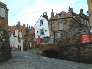
Reeth is both gorgeous and utterly weird! Remember this was a bank Holiday Sunday, and if you have ever watched the original Wicker Man with Edward Woodwood wood wood wood wood, then you have got an absolute spitting image of what I was seeing. I absolutely kid you not. As I arrived, the entire village were on the huge green, as the dusk was coming in. they had the preacher in the middle with a microphone, and they were all chanting together as the tourists looked on in jaw dropping amazement. There were crosses in all the windows and there was a totally weird atmosphere.

OK, maybe not quite a wierd as this, but not far off
Here is what it actually looked like in the morning, after all the chanters had finished their devil worshipping rituals and retired to bed exhausted.


I has concluded that Rufus really had had enough, so went to the phone box to call Karen so she could make her way up to collect him mid stage. Oh, and yes, Reeth had no reception for mobiles. Who needs mobiles when you can just tap your friends on the shoulder as your skipping round the maypole?!! Anyway, as I was on the phone I noticed a nice lady I had chatted to at times along the route. She later told me a guy behind her waiting for the phone had a sprained ankle who was seeking some medical attention and was waiting to call someone. She asked him how he had done it, and it turned out he was jogging the route. He had set off from St Bees on the Friday, and made it to Reeth on the Sunday evening!! That was 113 miles in 3 days or 38 miles a day. He has been walking / jogging for 12 to 14 hours a day, walking by moon light, and sleeping only 4 hours per night. It's supposed to be fun!!
The group of C2C'ers who gather at the pub at night is getting larger and larger. it is now up to 11, and they all eat a meal together each evening. Oh, but I can't go, as I have Rufus, so it's Billy no mates again. Never mind, I can always watch telly. On no, I forgot, you can't. There is no TV reception either. All you can get is a fuzzy BBC1, so it's off to bed.
The morning is the same old same old due to Rufus. Not allowed in the breakfast room, and I have to wait for them to set me up a pub table in the cold bar area. Then they forget about me whilst feeding the warm comfy guests. I eventually get my breakfast, but no bacon, so Rufus gets the lot this time. he needs all the energy he can get.
End of Stage 7
Kirkby Stephen to Danby Wiske - 24 Miles (59 miles to go)
Route / Ascents used:
Climb up to Marrick, cross coutry to Marske, Applegarth to Richmond. Follow River Swale to Bolton-on-Swale, road to Danby Wiske.
As mentioned, I had decided Rufus had had enough, and certainly was not up for walking 2 stages in one day as this was at 24 miles, so I planned to meet Karen in Richmond, mid stage, have lunch and leave Rufus with her and meet her at Danby Wiske at the end of my days walking.
Rufus was on good form to be honest, and the walk down to the Priory and then up the steep climb through Steps Wood was really fun. The path through the wood was amazing, like a pavement, only on a 1:4 gradient.
As I had to motor on, I caught up a couple who had set off earlier than me from Reeth. You tend to come across people, and as you have different walking schedules and different destinations often, you tend to just chat, and never ask what each others names were. As it happened, I got chatting to this couple, and really got on well with them, but have no idea of their names.

It turned out the chap was a Pharmaceutical company executive, so that got me onto discussing whether they had any miracle cures for cancer on the horizon I could mention to Karen. He was a really interesting person. His wife was really funny and friendly, and they got on with Rufus really well. We were joined later by a young guy (again no idea of his name) who had been walking previous stages with this couple so we all merged into a merry group chatting and laughing.

It turned out this new addition to the group lived in London and knew precisely whare I lived so we had a good chat about the area and the walks Rufus was taken on.
We were getting on so well, we were amazed when we had made the 10 miles to the outskirts of Richmond by 1pm, only 3 hours later, having made it in a average of over 3 miles an hour. The first time I reached these dizzyingly fast speeds on the walk I think.
The young guy was heading off before we entered Richmond as he was catching a train back to London, then coming back in a week to complete the walk. The couple were ending in Richmond, stopping for a month before completing the walk in October. Well, horses for courses, but I think if you are doing the C2C as a challenge, you really need to do it in one hit in my view.

Richmond comes into view
We all said our good byes and I realised I was way too early to meet Karen, who was due in at 2pm. I decided to take Rufus down to the river whilst I had my packed lunch and waited. I had also packed some of my favourite "tosh" (Blackburn for Sweets) I had saved in my coat pocket for now. I adore Lions Midget Gems, and you can only get them up north. As it happened, in my haste to get here, they had disssolved into a sweaty mush! Well, they still tasted good though.

Richmond Park looking back at the castle
Karen arrived just after 1.30pm so we had a quick drink and off I set for the remaining 14 miles of the trek. Jeez, what a boring slog this was, with the final 5 miles on a road. I was really glad to see Karen at the other end, who was due to give me a lift the 4 miles off route to our B&B at Great Smeaton. Then I will be dropped back off the next day at this same point to continue on my way.
Great Smeaton was to be frank a dead end shit hole consisting of the pub and about 6 houses. They were really friendly, and we had to ask for dinner to be cooked specially. They asked us what our dog was called and laughed when they found he was Rufus as their own dog was called the same name. Their Rufus was not as nice as ours was though, so nah nah ne nah!
Off to bed and refreshed for the next day!
End of Stage 8
There's a Hole in My Shoe that is Letting in Water!
Now dear reader may be a good time to let you know how my faithful old boots are fairing. You know, the one's I confined to the the dustbin halfway through my Scottish Coast to Coast leg, but couldn't part with so dug them out again.
I wore my beautiful new boots but got such sore ankles and blisters I felt I couldn't risk wearing them on this trip. The only problem is, these boots are so leaky, I find I am squelching along on all boggy sections of the walk and my feet are getting pretty bad.
Well, here they are! Do you reckon they'll make it to the end? I am determined they will, and I refuse to put any other foot wear on. These are my boots I walked half the mountains in the lake District in, and climbed 16,000 ft mount Meru in Africa followed by 20,000 ft Kilimanjaro.


Danby Wiske to Hollin Hill - 14 miles (45 miles to go)
Route / Ascents used:
Cross fields and railway line to A19, Ingleby Cross, Climb through Arncliffe Wood (984 feet), Clain woods to Hollin Hill.
Today is Karen's birthday, so we plan to have a nice meal and a wander around somewhere of her choice looking for a piece of art, I think. Karen has business to attend to in Darlington, so asks if Rufus would be up for a final stage with me before his well earned rest. OK, say I, it should be an easy leg today - heh heh heh! Now Rufus, your mummy's left you with your wicked daddy, who'll devise some option to make this as tough as possible, either by design or accident.
Karen dropped me off at Danby Wiske at 9.30am and I was motoring along so well, I rang Karen and said I wanted to press on and go beyond Osmotherley and knock off as much as possible from the really long slog the next day. I felt really confident I could knock off 14 miles by 3pm, which would normally take until 4.30pm. The weather was absolutely boiling, so it was on with the paisley buff for my bald bonce and head down, and away!
To be honest, there aren't many images I took today, mainly because it was featureless flat landscape for the most part. It got interesting once I got to the A19. For those of you who saw the Julia Bradbury C2C series, you may recall her dicing with death to get across this incredibly busy dual carriageway. Well, it is no joke getting across this road. You have lorries travelling at 60 miles an hour, and cars speeding past them in the outside lane at up to 100 miles an hour. You then have to time it to sprint to the central reservation, hoping a car isn't coming from nowhere to mow you down. Then it's repeat all over again for the other side of the road. I would say it took me a good 5 minutes to get across the road safely with Rufus.
On the other side, things start to get more interesting. You arrive in the tiny hamlet of Ingleby Cross, which is lovely, and most people stop here as end of their stage. But not me! I was trying to knock off some extra miles if you recall.

We crack on into Arncliffe Woods, skirting past Osmotherley. This turned out to be a huge and endless climb, so I was glad to get this out of the way from tomorrow's leg. As I reach the top of my endless climb, a magical view opens up of Roseberry Topping, a beautiful mountain, sitting incongruously in an otherwise flat landscape.

Here she is, sitting proud in her bland surroundings.

Here is a more arty pic I have nicked off the internet, but shows her off in all her glory.
Roseberry Topping means more to me than most, and she accompanied me and Rufus for 3 long days of our journey. This lovely mountain was effectively in my back garden for the 5 years I attended a Quaker boarding school in the village of Great Ayton. I cannot begin to say what acts of mischief and debauchery she witnessed from your humble author throughout all those years! As punishment for the multitude of rules I broke on a daily basis, I would be forced to get up at 5.30 in the morning, and don my shorts and vest and run the 3 miles to the top of Roseberry Topping and back, the aim being for slackers, you would miss your breakfast at 7am. I never did, and I never tired of running to the tops and back. The mountain was riddled with abandoned Iron Ore mine shafts and we found the entrance very early in my time at the school. We used to wander in absolute blackness, with only a weak torch for company, for miles and miles, using nothing more than a mental map of where we were. We used to walk as far as we could before the air got so thin we couldn't go any further. Our naive view was that we could train our lungs to get us further each trip. We stole a standard from the rally cross trail and pitched it at the furthest point we got to each trip, like it was a Union Jack at the North Pole. Whenever I reached it next time, I used to suck a strained lump of stale air into my lungs, and run as far as I could go and thrust the standard into the ground before I blacked out and run back to fresh air. We thought if we went far enough, we would eventually come out the other end, but never managed it.
At this point, the weather was getting unbearably hot, and I think you can see that the flagging Rufus was absolutely at the end of his reserves of energy. It really was time for him to go home.

We continued on into Clain Wood and descended to Scugdale Beck with a short hop to Hollin Hill and my rendezvous with Karen. We had made it by 2.45, so pretty damn good going I would say. We collapsed in a satisfied heap and sunbathed whilst I waited for Karen. I would continue alone from this point tomorrow for the rest of the journey to the east coast.
Karen eventually arrived about 3.30 and we decided to go to Osthmotherley to have a look around.

This is where we parked
 This is where I drank a pint of Thwaites Wainwright bitter. Take note "Man and Boy"
We had to wait until 5 to arrive at Ellerbeck where our B&B was for the night. This was run by a lady called Gillian Shepherd, who turned out to be amazing and an utter legend! She said she wouldn't be around 'til 5pm as she had to help an old lady get to Osmotherley. i thought this was a ruse to just keep me and Rufus away for as long as possible. As it happened, we saw a woman helping a really disabled old lady into a crumbling home across the way from where we were drinking. Karen said, 2I bet that's Gillian", and I laughed and said it might well be. Turned out it blooming well was! When we arrived, she utterly fell in love with Rufus and declared she has exactly the same breed as Rufus, but a girl called Lucy. When they did meet up, she was an English Springer, not Welsh, but we kept quiet. Also, Rufus was too knackered to get up to his usual antisocial shagging, being utterly shagged out himself!
Gillian forced us to sit down in her eclectic living room (the entire house was the same, with ornaments and kitch 70's mock beams and wooden slatted ceilings everywhere), and be treated to high tea. It was amazing. She brought out a steaming pot of tea, and one of those tower cake things, with hot buttered tea cakes, homemade coffee cake, scones, cream jam and on and on!! We really weren't hungry, and had to save some space for our meal later. So we nibbled on tea cakes. so as to be polite.
Gillian comes in, and notices Rufus has picked up a tick from the moorland, and proceeded to remove it with surgical spirit. Rufus was sneezing all over the place with the fumes, and she persisted in dragging the beast from his forehead. Then, as if this was not enough for the poor wee thing, she drags him up onto her lap, with his forelegs out front, and proceeds to cuddle him, cooing and rocking back and forth. It was utterly excruciating, and all I could see was this look of panic in Rufus' eyes appealing to me and Karen saying, "Help me, for God's sake!" No help was forthcoming, so Rufus resorted to the only other defense mechanism he had left in his armoury. He just went to sleep and started snoring!!
I asked Gillian where I could take Karen out for her birthday meal, where they would accept dogs. She stated firmly that we would be going to The Golden Lion at Osmotherley, and she would book us the table, and that Rufus would be remaining with her! Poor Rufie. We were grateful and proceeded to get ready for going out. We sneaked out and left Rufus with Gillian, and left our phone number, mainly for Rufus in case he needed to get out in an emergency.
We arrived at The Golden Lion, and the manager came out to greet us saying, You must be the guests of Gillian of Ellerbeck, welcome. It sounded like an episode of Robin Hood, with Sir Guy of Gisburn or Sir Robin of Loxley! We had the Lady Gillian of Ellerbeck. She was clearly famous in the region.
The meal was great, and it was nice to be able to relax without worrrying about Rufus. We got back for about 8.30pm and Rufus seemed to be really at home, and was ignoring Lucy, which was lucky.
Breakfast was another gargantuan feast in the morning, and our pack lunches were massive, with, yes, you guessed it, Coffee cake included. Well, she had cut the slices for us the day before, and she was damned they would go to waste!
Karen drops me at Hollin Hill to continue on alone for the remaining 3 stages to Robin Hoods Bay. Off I go.
End of Stage 9
Hollin Hill to Red Lion Inn - 16 Miles (29 miles to go)
Route / Ascents used:
Live Moor (1,033 ft) to Calton Bank (1,339 ft) descend 1,000 ft and climb to Cringle Moor (1,417 ft) descend 1,000 ft and climb to Broughton Bank (1,319 ft), descend 1,000 ft and climb again to White Hill (1,306 ft) descend 500 ft and climb again to Round Hill (1,490 ft) Bloworth Crossing and then the dismantled railway line via High Blakey Moor to Lion Inn.
I delivberately made it clear in the route breakdown just how tough this leg was. If I hadn't done the extra miles and climbs yesterday, I would have had six ascents of over 1,000 ft plus 20 miles of walking today. As it is, this was still an unbelievably tough days march. The landscape was bleak and desolate moorland whcih is fine for a while, but mile after mile, becomes dull and boring.
The image below is the top of Calton Bank, my first peak of the day, with a good view of Roseberry Topping in the distance.

I didn't really mind the dropping and climbing, and each fell top did represent a different challenge. As I came down off White Hill and crossed the road, I went up the wrong path and had to climb down 500 feet to the bottom to pick up teh right path to Round Hill. Once I got to the top of the Round Hill, the teadious landscape kicked in.

Bland and featureless!
I had to walk for miles before I saw any break in this featureless landscape when the lovely Farndale came into view.

Soon after, I dropped down onto the dismantled railwaywhich winds its way around the valleys of Farndale, Rosedale and Great Fryup Dale. This was where the grouse shooting was going on all around you.
I think this image below illustrates really well just how desolate the landscape was, and endless!

I was passed soon after this shot by something akin to a golf buggy for about 12 people. I asked the guy what he was doing up here, and he told me he was the transposrt for the grouse beaters, and that I was within range! he tried to reassure me that the shooters knew I was around, and were waiting for me to get behind the vehicle so I wouldn't get hit. As I passed him, he shouted after me, "that's all assumin' they got their coordinates right"!
There is not a lot to say for obvious reasons on this stage. I got to within 2 miles and my thighs were burning so much, I had to lie down and rest for 20 minutes. I was way ahead of schedule having knocked off those 4 miles the day before. Two cyclists passed me when I was lying on my back, and I wonder if they thought I had died. if so, they still ignored me!
I got back on my feet and trudged round the bed. This was the view I got of the Lion Inn, way ahead on the horizon, literally in the mifddle of nowhere. It was a long trudge to get there and ring for my lift down the valley to my B&B in Rosedale.

The B&B was nice, with tea offered in the garden as I arrived. I had eaten at the Lion Inn, so did not need to bother them for further lifts to anywhere to eat. The guy who gave me a lift was due to drive me back to the Lion Inn for 08.30 the next morning, so I got a good nights sleep ready for the off.
End of Stage 10
Lion Inn to Grosmont - 14 Miles (15 miles to go)
Route / Ascents used:
The B&B guy gave me the lift back to The Lion Inn for 08.30 in the morning. He kept giving me anecdotes about walkers going the wrong way on the moors and cutting corners and being unprepared, as if I would immediately call for a taxi to the next destination. He told a story of a girl and guy who were not partners who got this far, but were camping, and the woman ran out on him in frustration. This was after he told her to make the breakfast for the 10th time while he did the man thing and read the map for the millionth time. I don't know why she was so touchy, this sounds quite reasonable to me!
He drove past the turning I would make 2 miles further on across the moors towards Grosmont, and I have to confess, I was tempted to say, OK, just drop me here, but I knew he was a purist, and to be frank, so was I. Regardless of the tedious nature of this moorland section, the walk is there to be done, and it has to be done properly. So on we went to the Inn car park, and he swiftly drove off. Here I am, alone again in the middle of nowhere. SIGH!
I set off and make a beeline for "Fat Betty" and at least take the pleasure of a permissive C2C shortcut to snip a fraction off the long road curve around Rosedale, and to keep off the road section as much as possible to protect my feet. I arrive at Fat Betty after about 45 minutes.
Fat Betty
I have spoken about this comely wench several times now, and I have no idea who she is. If you hadn't gathered by now, she is a monument, and not a human being. She is actually referred to as a white cross, and legend has it a local farmer's wife, Fat Betty, fell from their horse and cart on a dark, foggy night. When he arrived home and noticed she was missing from the back of the cart he retraced his route across the moor and all he could find was the large, squat stone!! What a laugh. What a douche bag, firstly for referring to his wife as "Fat Betty" in the first place, and secondly for not noticing she had fallen off his cart.
Tradition states now that you leave a sweet for Fat Betty, and you will always find some left from previous walkers. You are supposed to pick one up and leave another in its place. Well, when I checked, all I could see were wrappers and no sweets, and I kind of felt Betty was looking a little thick about the waist and could swear I heard someone burp as I turned my back.
Well, here she is in all her glory.

I continued on across the Moor along Great Fryup Dale. Another reason possibly for the alleged rotundness of the delectable Betty perhaps? I am pretty certain i can see the coast from this part of the Moor. What do you reckon dear reader?

Click on image to expand and check if that is the sea on the horizon. I thought it was.
If so, this may have been my first clear sight of the North Sea, and my destination tomorrow.

This is a view down into Great Fryup Dale.
I continue on down Glaisdale into village, and pop into the butchers for a pork pie (now whose fat?), and carry onto Glaisdale Station and enter into East Arncliffe Wood, aiming for Egton bridge. My aim is to have my lunch here for the day. When I arrive, it doesn't appear as the prettiest village in North Yorkshire as the sign post suggested 4 miles back! maybe that is Egton, not Egton Bridge, so I am a little disappointed. In any case, I get a pint of Shandy (it is the middle of the day after all) from a nice pub and sit in the garden.
I am way ahead of time as this is a relatively short leg, and try to take my time as I set off slowly for the amble into Grosmont along the lovely River Esk. I eventually arrive at my destination about 2.30pm and realise, apart from the choo choo steam trains, there is bugger all else going on in this tiny village. I guess if you are an steam enthusiast, as I am sure Wainwright was, this village would be heaven to arrive at early. As it happens, I am not a steam enthusiast, and once I had taken the obligatory tourist snap of the train coming onto the platform I was at a loose end. I must confess I did feel like I was in a scene from the Railway Children, and expected the father to come limping out of the fog of steam, and we would all start bawling uncontrollably.

Well here it is for all you steam enthusiasts. Woooh!
I was desperate, so took a stroll down to the Engine shed and looked at a steam train being repared first hand. I was looking at some of the kids with their parents, and I could see them straining to convey excitement and enthusiasm, but it just wasn't working.
I apologised to someone at the railway Tavern, where I was staying, for being so early, but asked if I could go to my room and drop off my stuff.
It was no good, I had to go for a walk along the Railway Trail, despite my tired limbs, I just had to get out of here.

A lovely floral display on the way to the engine sheds.
That night, I met up with the ever expanding group who were walking the same route and same stops as me. They are such a lovely bunch of people, and I regret not having had the chance to become part of this group earlier on. As mentioned, it was often difficult with Rufus as he would prevent me being able to eat in the dining areas where all the revelry would be going on. Tonight was different, and they very kindly invited me along, which was really appreciated. They were a really close knit group, which just shows what bonds you create in adversity. It appears they have a trail song to set them on their way each morning, called "on the road" which one of them has been tasked to learn word for word by the morning. Good luck on that one.
Tomorrow is supposed to start with a climb from hell. A 1:3 climb on road for over a mile out of the village. I like to start with a tough climb to loosen your muscles and tendons, but want to get off early, so I can beat the rush, and ensure I get to Robin Hoods Bay by 3pm at the absolute latest so I can meet up with Karen and Rufus. So I go off to my room and a good night's sleep to be ready for the final day.
End of Stage 11
Final Stage - Grosmont to Robin Hoods Bay - 15 Miles ( 192 miles completed plus at least another 10 for navigational errors!)
Route / Ascents used:
Steep ascent to High Bride Stones (948 ft), Littlebeck and then due south through Scarry Wood to Falling Foss, eturning north across moors to Hawsker, along the Cleveland way coastal path south into Robin Hoods Bay.
As I have mentioned before dear reader, Wainwright is an utter sadist, and the final stage was absolutely no exception. Firstly, he includes a 1 in 3 climb whilst your breakfast is still settling in your stomach, then decides to walk 4 miles south (not East) in his itinerary, and to cap it all, then walks north past your destination, just to give you the treat of an extra 4 miles torture before arriving at your destination. As the crow flies, you could probably have done this stage in 10 miles, but to be fair, the additions really are worth it.
So as mentioned, my day starts with an endless climb up a sheer 1 in 3 hill via road to the summit at High Bride Stones. To be fair, I enjoyed this section of the walk, as I like climbing. I set off early at 08.30 to beat the rush from Grosmont, and to ensure I would make it to Robin Hoods Bay by 3pm at the latest to meet Karen and Rufus. I spared a thought for the guy in the massive group who had been tasked to learn every single word to the Willie Nelsen song, "On the Road" by the morning for their clarion call. I hope he didn't stay up all night to learn them, as I'm sure you could just make them up just the same. I reached the summit by around 09.15 so had made good time. I decided not to follow the road route all the way as indicated, but to come off road over Black Brow to come round in a wide arc. This was to avoid the need to turn left onto the busy A169 and walk along the road. On my route, I met the A road at the point I needed to simply cross over to to the trail to Littlebeck. As I wallked across the moor, I came across these stones, which I guess are related to the Bride Stones, but don't seem to feature on the map. I thought they looked great.

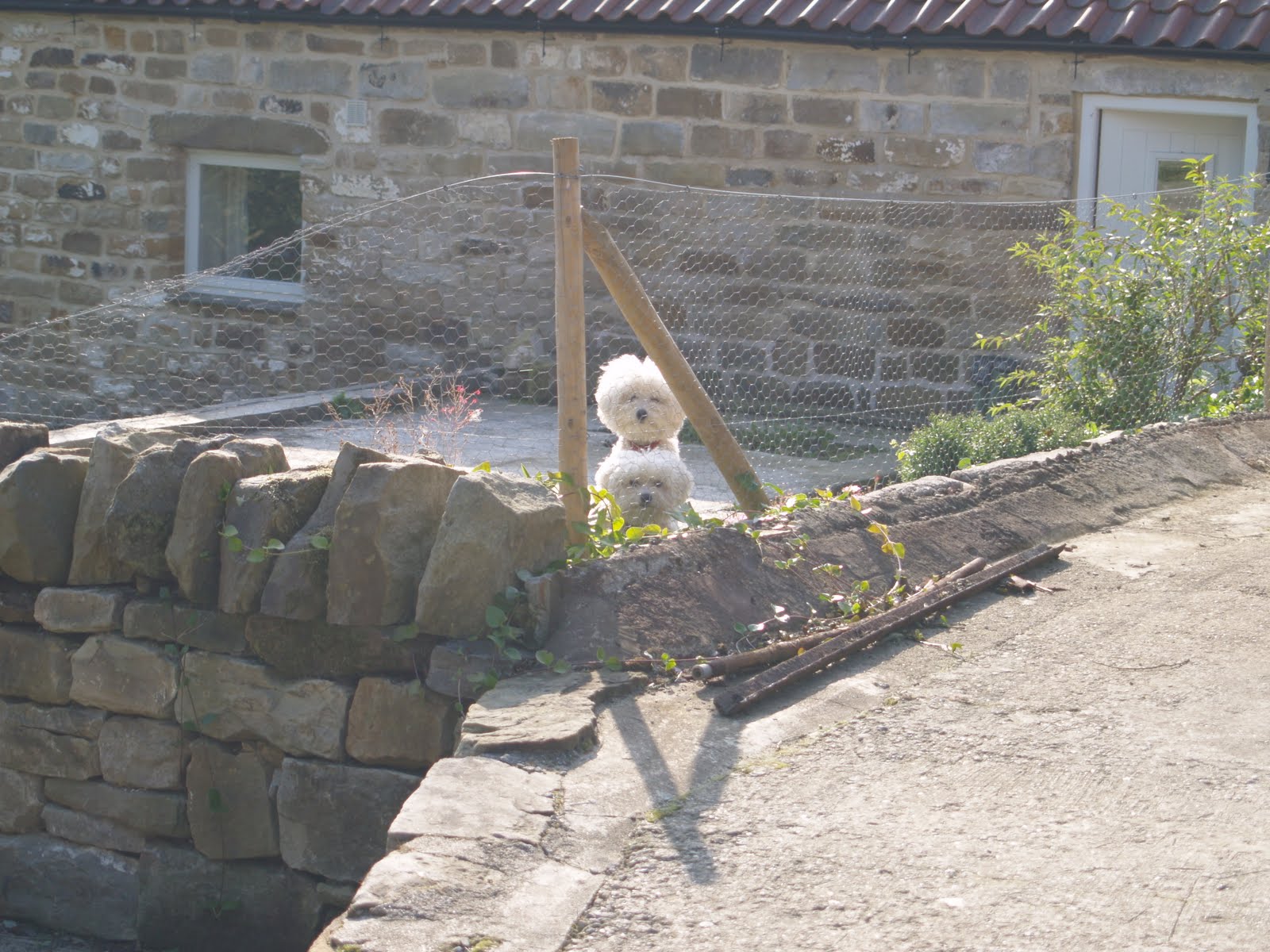
As I came into Littlebeck, I passed a farmyard with these two Bijon Frises, who watched on in silence, but appeared like a weird siamese twin with 2 heads. As I went closer, I could see that one had simply climbed on the back of the other to get a good vantage point!
In Littlebeck, I reached the point I had to turn south and walk away from my destination and walk down to Falling Foss via Scarry Wood. It was lovely, and I can understand why Wainwright makes this diversion to maintain interest on the final run in to our destination.

I was always grateful for signs like this which reassure you that you are still on the C2C route despite being in the middle of nowhere.
Halfway on my diversion to Falling Foss, I came across the Hermitage.

Here is 'The Hermitage' which is thought to have been hewn out of a single rock in 1790 (inscribed above the doorway)reputedly by a George Chubb whose initials are also carved above the door.
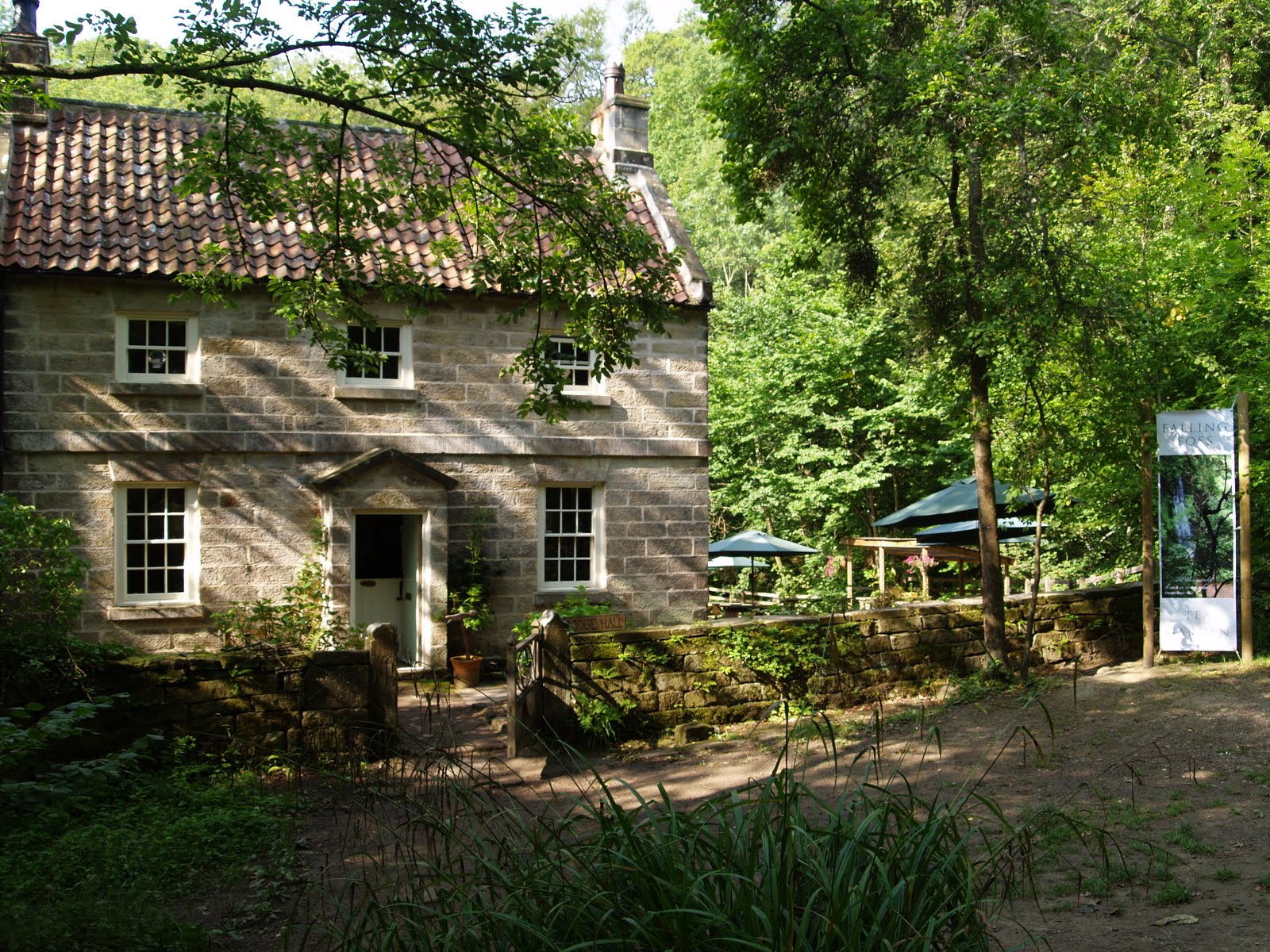
Eventually we arrive at the Falling Foss Falls, which were a bit of a let down to be honest. I have witnessed more impressive showers in my B&B's than this weak spout, but the walk to get here made the diversion worth while.

Just behind the falls was this lovely and inviting cafe. I was on a mission, and had no time to waste having tea, so I cracked on. However, when passed later on the walk by a couple, they remarked that the main group from the night before had stopped here for refreshments. They were living the high life, and I was jealous, but had to make it to Robin Hoods Bay in time.
As I broke out of the wood, and crossed the moorland beyond, the North Sea came tantilisingly into view. My destination seemed within my grasp now.

You can see the sea beyond the tree. This sentence rhymes far too much for my liking!
As I cross the B1416 and start to walk across the final section of moorland, Whitby comes into view and you can see the abbey clearly on the right. This just shows how far north Wainwright makes you come before heading south to Robin Hoods Bay.

If you click on the image, you will see the abbey clearly on the hill to the right of Whitby.
 Here is an image of the abbey I took a year earlier in February. I am trying to look scared as Dracula was supposed to have landed here, according to Bram Stoker!
As I mentioned earlier, I was overtaken by a scottish couple who were taking this last stage at a canter. They had already done the C2C before, so were clearly suckers for punishment! I kept catching up to them as they stopped to consider which way to go, only for me to bellow, "straight on", as I had the big OS map to hand. I eventually passed them as they stopped for their pack lunches at a good spot in the grounds of Hawsker Bottom campsite just before you drop down to the coastal path.

A lovely spot for a picnic.
Just beyond this point, I dropped down onto the Cleveland Way and joined the coastal path south towards Robin Hoods Bay. I have to say, I let out a whoop at this point. To all intents, I had now successfully made it from coast to coast, and I felt an immense surge of pride. Pity that b****** Wainwright now had me walking a further 4 miles before I could officially say it was over.

Sign for the Cleveland Way pointing the way south to my destination.

View south to Robin Hoods Bay, which would be just around the corner on the horizon.
After about an hour, I rounded the corner and Robin Hoods Bay came into view for the first time. My destination at last, after 12 gruelling days and 200 miles of hard walking.

My destination at last.
At this point one of my favourite songs came into my head, 25 Miles by Edwin Starr, and wouldn't let go!
"I turn a back over flip and I'll forget these feet of mine.
I got to keep on walkin'. I got to walk on. oh ho hoI, I, I, I, I'm so tired but I just can't lose my stride.
Walk on let me tell you ya'll I, I, I, I, I, I'm so tired, but I just can't lose my stride.
Come on feet don't fail me now, I got ten more miles to go. I got nine, eight, seven, six, I got five more miles to go now, over the hill just around the bend. Huh although my feet are tired I can't lose my stride....." etc
I guess you get the picture huh? I think you have to hear it for it to be clear.
Down I came into Robin Hoods Bay at last, and when I say down, I mean DOWN!!

Oh my poor aching legs! The walk down to the sea was pure torture at the end of a long stage.


Here I am at the official end of route sign with my faithful companion Rufus.

Here is my best Mike Hammer impression complete with baggy trousers. yes, I can touch it!

A lovely shot with Rufus playing to camera. He's such a show off!
That night, Karen Rufus and I take up the recommendation of our landlady and go to the Dolphin pub for a meal. This was lovely, but turned surreal, when at 9pm, the place turned into a folk club. We were sharing a table with a lovely couple who were camping nearby and had come back specially for this amazing experience. Well then, it must be good thinks I.
No comments:
Post a Comment